The drive from Mt. Tam, as it affectionately called by the locals, to Marin Headlands was quick and uneventful. The most noteworthy moment was when I stopped at the grocery store to procure some foodstuffs for dinner and was forced to lie to a little girl, telling her I would by some girl scout cookies on my way out of the store. Luckily, the girls were busy with other customers when I was leaving and I was able to slink back to my car unnoticed.
It was another clear day in the bay area, and once again I was greater with a fog less view of the Golden Gate and the communities around the San Francisco Bay. It was still early in the day when I got to the visitor center. I had reserved a campsite for the night a couple days prior, making this the first day I had made sleeping arrangements before the day of. It was a nice relief to know I wouldn’t be scurrying for a place to sleep at night.

I drove up to the campsite and was amazed by the view. The campsite sat at the bottom of a steep hill, a picnic grove sat at the top, along with the parking lot. The view form the picnic area was stunning, a marvelous panorama showing off the Golden Gate and the San Franciscan Skyline beyond. I walked my tent and sleeping bags down the hill and set up for the evening. It was still early but I wanted to do some exploring and had little intention of having to fight with building my camp in the dark.
This was my sixth night sleeping in the tent in the last week, and as a result I had become rather proficient in setting up. It may have taken my about ten minutes to set up but by the time I walked back up to my car the world was shrouded in fog, the bridge and skyline erased from view, replaced with a blackout of white that stretched in every direction. With the sun blocked the air felt cold and I grabbed a sweatshirt before heading out to explore.
I walked through the fog to an old battery, once used by the military to defend San Francisco bay from being infiltrated by hostile ships. Today the batteries are visited by visitors to the park who enjoy revealing in the old structures, as well as a more nefarious set of visitors who enjoying using the decommissioned buildings as canvases for their not so aesthetic art projects (read crappy graffiti).

The fog masked most everything not within a few feet of me and I walked along blindly with no real destination in mind. My wandering led me to a parking lot full of cars, apparently I had found some popular attraction, so I followed the crowd, a sign informed me I was headed to Point Bonita Light House. The fog lifted slightly allowing me to see down to the ocean below as it crashed gently into the cliff walls. A group of seals sat lazily on a rocky outcrop while a colony of Common Murre diligently watched the sea, confusing a group of children into believing they were penguins. I hadn’t the heart to tell them, so I moved on before I had to hear some less empathetic adult crush their poor little dreams.
 |
| Some deer on the cliff side, who I totally didn't write about but they were there, proof that there's more then what I write. |
To get to the lighthouse you must walk through a tunnel, which was only open for a few hours three days a week. I looked at my watch and realized I had 15 minutes before the tunnel closed, and raced through. On the other side of the tunnel, through a thin veil of fog the lighthouse could be seen, it’s bright light failing to break through the fog.
 |
| Entrance to the tunnel |
The lighthouses in the bay, and I'm sure most other places in the world, are equipped with fog sensors, which when triggered, initiate a fog horn, each lighthouse has it’s own unique horn blast, just as each lighthouse has it’s own unique blinking pattern. The fog horn blared into the endless whiteness, informing ships of their location.
 |
| I know what you are thinking, "if there is so much fog how do you get these pictures?" Patience my friend patience. |
I walked across the bridge to the lighthouse itself, a swaying suspension bridge that dangles a hundred feet above the touch surf, it’s jerky motions not the most comforting as I hurried across. The lighthouse is still used today, as you probably realized by the above paragraph, but the rest of the building is abandoned, and was filled with placards and displays explain the history of the site. Other, more enthusiastic, lighthouse fans stood and read the signs, I just grabbed a pamphlet and venturing back outside. A few pictures showed the view one would see on a cloudless day, miles out to sea, across the mouth of the bay and even down the bay itself, but today it was a lighthouse on an island in a sea of puffy opaque sea smoke.

I had barely made it in time and within a few minute the rangers came around informing that the tunnel was closing. I was one of the last people to leave the lighthouse and by the time I returned to the parking lot all but a couple cars had left, I decided to follow an adjacent trial down to a beach, the fog was being blown around by a strong wind coming off the see, the air visibly moving across the still landscape.
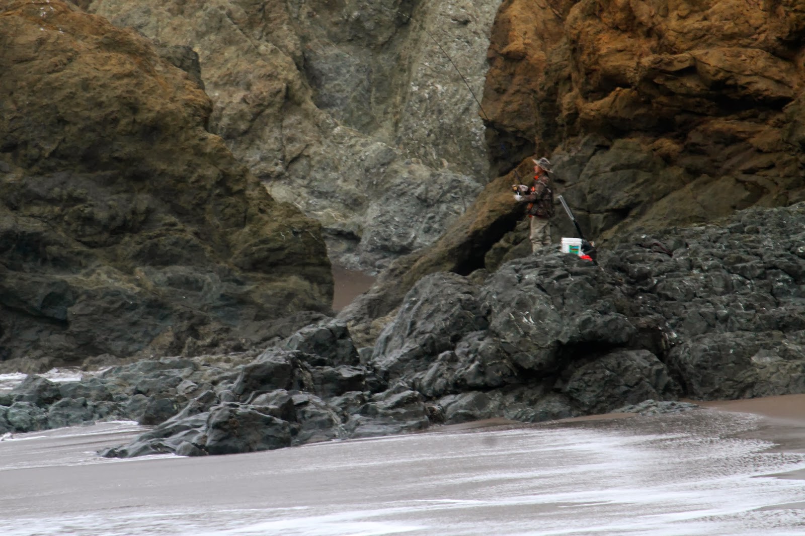
Down at the beach two men were fishing, as a lone sea lion swim in the surf. The beach was below the fog, a low lying cloud hung just above my head, the waves crashing along the shore the only sound. I decided to head to another decommissioned battery before heading back. I was alone at the battery, and the thick fog made the old structure look spooky. Again graffiti covered much of the structure, ruining the ambiance of the historical fortification. I left disappointed that the fog and vandalism had obstructed my evenings hike.

I returned to camp and made myself dinner. Darkness followed not long after and without much to do I decided to go to sleep. The temperature was not nearly as comfortable as it had been on Mt. Tamalpais, but it was still warm enough that I was able to sleep undisturbed.
No comments:
Post a Comment